KabarJawa.com — Mount Merapi again showed its volcanic activity by releasing hot clouds of avalanches on Monday (1/6/2026) afternoon.
This incident was recorded through the monitoring instrument of the Geological Disaster Research and Technology Development Center (BPPTKG).
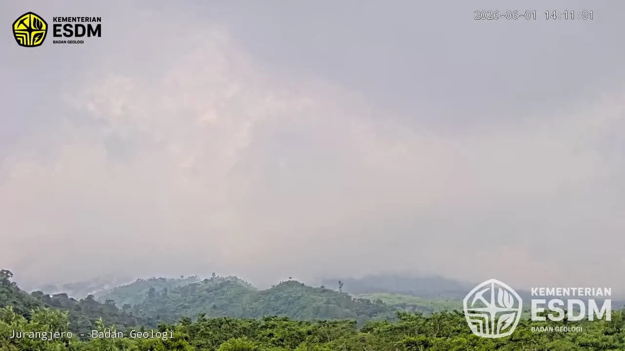
Hot cloud avalanches occurred at 14.09 WIB. At the time of the incident, the top of the mountain was covered in fog so it could not be observed visually.
However, monitoring equipment recorded a hot cloud with a maximum amplitude of 64.04 millimeters and a duration of 88.58 seconds.
Head of BPPTKG, Agus Budi Santosa, said that Merapi’s volcanic activity still needs attention because the supply of magma to the surface is still ongoing.
“Monitoring data shows that the supply of magma is still ongoing. This condition can trigger lava avalanches or hot clouds of avalanches in designated potential danger areas,” said Agus Budi Santosa.
Volcanic Activity Still Ongoing
Before the hot cloud avalanche occurred, a number of volcanic indicators had shown quite intense activity on Mount Merapi.
Based on observation reports for the period from 06.00 to 12.00 WIB, the weather in the peak area was observed to be sunny to cloudy.
The wind blows weakly to the east and west with air temperatures ranging from 22 to 25.9 degrees Celsius.
Officers also observed white smoke from the crater with light to moderate intensity which reached a height of around 25 meters from the peak.
Meanwhile, seismic data recorded 29 earthquake avalanches with an amplitude of 2 to 29 millimeters and a maximum duration of 235 seconds.
Apart from that, there were 14 hybrid or multiple phase earthquakes which indicated the presence of fluid and magma dynamics within the body of the mountain.
During the same period, two shallow volcanic earthquakes were also recorded.
This type of earthquake is often associated with magma activity at depths relatively close to the surface.
Surface activity is still ongoing in the form of six incandescent lava avalanches to the southwest via Kali Sat, Kali Putih and Kali Krasak.
The maximum sliding distance of lava avalanches was recorded at two kilometers.
This series of data shows that the magma supply process is still ongoing and the material that has accumulated in the lava dome has the potential to collapse which could trigger hot clouds of avalanche.
The public is asked to remain alert
Currently, Mount Merapi’s activity status is still at Level III or Alert.
The Geological Agency emphasized that the main potential danger is still in the form of lava avalanches and hot clouds of avalanches.
In the south to southwest sector, potential dangers include the Boyong River up to a distance of five kilometers from the peak.
Similar threats were also found in the Bedog River, Krasak River and Bebeng River within a radius of seven kilometers.
Meanwhile, in the southeast sector, areas potentially affected include the Woro River up to three kilometers and the Gendol River up to five kilometers from the peak.
Apart from hot clouds and falling lava, the public is also asked to be aware of the potential for volcanic material to be ejected if an explosive eruption occurs.
This material can cover an area up to a radius of three kilometers from the peak.
Agus Budi Santosa appealed to the public not to carry out activities in designated potential danger areas.
Residents are also asked to increase awareness of the threat of rain lava, especially when it rains in the peak and slopes of Merapi.
Volcanic material that is still piling up on the slopes can be carried away by water flows and form lava which has the potential to threaten areas along rivers that originate at Mount Merapi.
Apart from that, the public needs to anticipate possible disturbances due to volcanic ash if large amounts of material fall or eruption occurs.
BPPTKG ensures that monitoring of Mount Merapi’s activity is carried out 24 hours a day.
Each development is continuously analyzed to detect possible significant changes in activity.
Communities around the slopes of Merapi are advised to remain calm, not easily believe unverified information, and follow developments in official information from the BPPTKG and the Geological Agency.
PakarPBN
A Private Blog Network (PBN) is a collection of websites that are controlled by a single individual or organization and used primarily to build backlinks to a “money site” in order to influence its ranking in search engines such as Google. The core idea behind a PBN is based on the importance of backlinks in Google’s ranking algorithm. Since Google views backlinks as signals of authority and trust, some website owners attempt to artificially create these signals through a controlled network of sites.
In a typical PBN setup, the owner acquires expired or aged domains that already have existing authority, backlinks, and history. These domains are rebuilt with new content and hosted separately, often using different IP addresses, hosting providers, themes, and ownership details to make them appear unrelated. Within the content published on these sites, links are strategically placed that point to the main website the owner wants to rank higher. By doing this, the owner attempts to pass link equity (also known as “link juice”) from the PBN sites to the target website.
The purpose of a PBN is to give the impression that the target website is naturally earning links from multiple independent sources. If done effectively, this can temporarily improve keyword rankings, increase organic visibility, and drive more traffic from search results.